


The Ultimate Manual for Geospatial Data Annotation
Geospatial data annotation is a fast-growing domain in the field of modern technology that combines geographic information systems (GIS) and data annotation techniques to provide precise, detailed and actionable insights. Informed decisions are made by businesses, researchers and governments through an understanding of how to utilize geospatial data. This article will get into specifics about geospatial data annotation, its uses, and why Macgence can be relied upon for quality geospatial data annotation services.
What is Geospatial Data Annotation?
Geospatial data annotation entails marking and tagging geographical points to render them usable for machine learning models and various analytics’ purposes. This process aids in identification as well as classification of features such as roads, buildings, vegetation or water bodies on maps as well as satellite images. The annotated material then goes ahead to train algorithms with capabilities of predicting or analyzing spatial patterns among other trends.
Why Geospatial Data Annotation is Important
Enhanced Decision Making: Annotated geospatial data provides precise information that aids in urban planning, disaster management, environmental monitoring, resource allocation etc.
Improved Accuracy: High-quality annotations ensure that the data used in machine learning models is accurate hence giving better predictions and insights.
Efficiency: Automated systems trained with annotated geospatial data can quickly process large volumes of information reducing time needed for manual analysis.
Applications of Geospatial Data Annotation
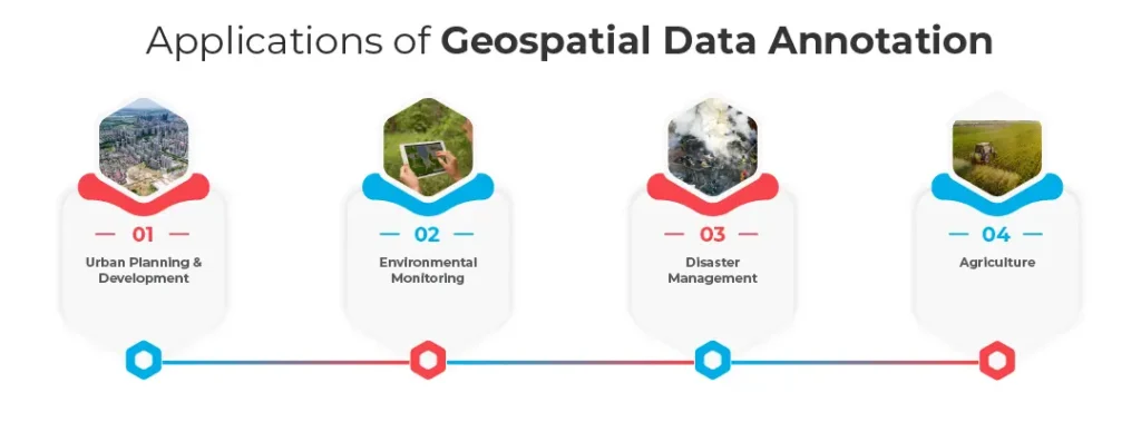
Urban Planning & Development
Urban planners utilize annotated geospatial data to understand how a city looks at present; where it can develop further from so as to plan infrastructural improvements/ projects etc. Smart cities are being developed using this data thus optimized traffic flow, efficient public transit system together with sustainable urban expansion.
Environmental Monitoring
Annotated geospatial information plays an important role in monitoring changes in the environment, such as deforestation, glacial melting, and urban sprawl. Analysts can examine this information to track temporal changes and predict future environmental implications.
Disaster Management
In disaster-prone areas, experts use geospatial data annotation to create detailed maps that assist in risk assessment and disaster response planning. This correct information enables timely evacuations and effective resource allocation during emergencies.
Agriculture
Annotated geospatial data is useful to farmers and agronomists who may have different reasons why they need them such as monitoring crop health, planning irrigation routines or managing land resources effectively. It assists in precision farming with a view of maximizing yield while minimizing waste.
How Macgence Excels in Geospatial Data Annotation
We are a leading provider of tailored high-quality geospatial data annotation services at Macgence for various industries. Here’s what makes Macgence different:
Expertise across Multiple Domains
Our team includes professionals from various sectors such as urban planning, environmental science, disaster management and agriculture with diverse knowledge base. This interdisciplinary approach ensures that our annotations are precise and relevant.
Cutting-Edge Technology
To offer reliable and fast geospatial data annotation, we use the latest tools plus technologies too. We have our own proprietary software along with machine learning algorithms that are specifically designed to handle complex geospatial datasets with ease.
Quality Assurance
Quality is central at Macgence; therefore we have strict quality control measures in place to ensure every annotation made has the highest accuracy levels as well as reliability standards, minimizing errors through multiple reviews hence maintaining consistency throughout all layers of the review system.
Customized Solutions
We are aware that every single project is different. That’s why we offer custom-made geospatial data annotation solutions designed to suit the needs of your specific case. If it is a small project or large-scale data processing, we have the expertise and resources to provide this service.
Conclusion
Numerous applications have proved this to be a powerful tool that converts raw geographical information into useful knowledge. It’s an immensely effective instrument whose implications stretch far beyond city planning or environmental monitoring scenarios, even though various fields deeply feel its impact.
Macgence is a leader in providing high quality geospatial data annotation services by utilizing our expertise, state-of-the-art technology and dedication to excellence. Connect with us to unlock the full dimensionality of your spatial information, driving smart decision-making based on facts rather than intuition.
(FAQs)
Ans: – It focuses on maps and satellite images, and involves marking geographic data points, paying attention to spatial relationships and geography features while geospatial data annotation is concentrating with marking geographic locations within maps or satellite images. However, for other types of data annotations, researchers can use text as well as audio or image files, but they do not consider geography in this case.
Ans: – In many ways geospatial data annotations can help to make businesses improve logistics and supply chain management, optimize delivery routes, enhance marketing strategies using location-based insights, as well as inform decisions on where to locate new stores or facilities.
Ans: – Geographic Information System (GIS) software, such as ArcGIS and QGIS, along with specialized annotation platforms like Labelbox and Cogito, serve as commonly used tools in geospatial data annotation. These tools possess unique characteristics that enable a high precision annotation process, facilitate ease in handling information, and ensure compatibility with machine learning models.

You Might Like

February 28, 2025
Project EKA – Driving the Future of AI in India
Artificial Intelligence (AI) has long been heralded as the driving force behind global technological revolutions. But what happens when AI isn’t tailored to the needs of its diverse users? Project EKA is answering that question in India. This groundbreaking initiative aims to redefine the AI landscape, bridging the gap between India’s cultural, linguistic, and socio-economic […]

March 7, 2025
What is Data Annotation? And How Can It Help Build Better AI?
Introduction In the world of digitalised artificial intelligence (AI) and machine learning (ML), data is the core base of innovation. However, raw data alone is not sufficient to train accurate AI models. That’s why data annotation comes forward to resolve this. It is a fundamental process that helps machines to understand and interpret real-world data. […]

March 6, 2025
Vertical AI Agents: Redefining Business Efficiency and Innovation
The pace of industry activity is being altered by the evolution of AI technology. Its most recent advancement represents yet another level in Vertical AI systems. This is a cross discipline form of AI strategy that aims to improve automation in decision making and task optimization by heuristically solving all encompassing problems within a domain. […]

March 5, 2025
Use of Insurance Data Annotation Services for AI/ML Models
The integration of artificial intelligence (AI) and machine learning (ML) is rapidly transforming the insurance industry. In order to build reliable AI/ML models, however, thorough data annotation is necessary. Insurance data annotation is a key step in enabling automated systems to read complex insurance documents, identify fraud, and optimize claim processing. If you are an […]